Car navigators are still in demand, and manufacturers create such a wide range that it will not be easy to get lost in it. We do not recommend buying the first gadget you like, as well as trusting some incompetent consultants in retail chains. The choice will take much less time and will give a more correct result if you use the search filter of a large online store. This is a very handy tool that only requires specific search criteria. Let's figure out what parameters of navigators are considered key, so that you determine how relevant they are in your case, and you can consciously choose the right device.
1. Varieties of GPS-navigators
A range of navigation aids for cars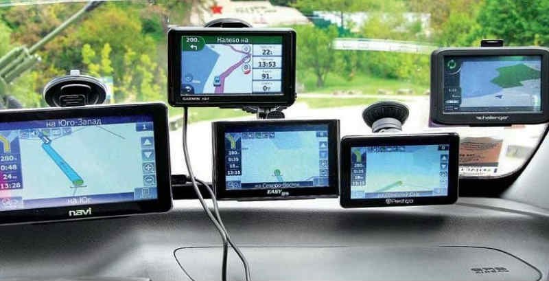
Compared to travel navigators, devices designed for use in a car are larger in size. This makes them more comfortable to drive while on the road.Sometimes motorcycle and bicycle navigators are classified as automobiles - they have a special mount on the steering wheel.
Depending on the installation method, there are 2 two types of autonavigators - built-in and removable. Stationary navigators perform the function of a radio with GPS, are built into a regular place in the center console, and are preferred when you want to get rid of unnecessary wiring and save space on the windshield. But their disadvantages (search for a model, installation, poor visibility of the screen from the driver's seat, high cost of updates, etc.) practically cross out the pros.
Portable navigators are more common, as they can be easily removed if necessary to be moved to another car, used as a pedestrian or taken home. Outwardly, they resemble a tablet PC and are usually mounted in a car using a complete suction cup bracket.
2. We set tasks
What functions - basic and additional - we can chooseThe capabilities of modern car navigators are no longer limited to positioning a car on the ground and deriving its coordinates. Most GPS devices, including fairly inexpensive ones, are capable of:
- lay several route options to the designated point;
- memorize the route and, if necessary, display it on the display;
- determine and display a number of navigation parameters - speed, direction, arrival time;
- understand instructions in voice mode and give hints while driving;
- inform about the rules of the road in force in this area.
More advanced models are as close as possible to tablets in terms of functionality and can perform a number of other tasks:
- record the situation in front of the car (DVR function);
- call, receive and send messages (GSM/GPRS module and SIM card required);
- notify the driver about the received signal of the traffic police radar;
- show information about traffic jams formed nearby.
And this is not a complete list, because through the navigator you can listen to music, watch movies and channels through an mp3 player and TV tuner, transmit sound to the car's audio system via an FM transmitter, etc.
3. How important are dimensions
How to choose the right diagonal and display resolution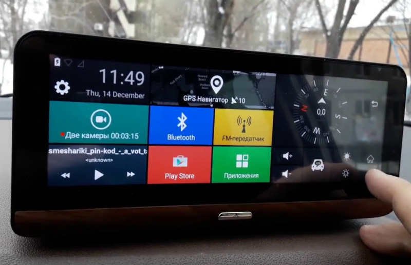
Any navigator consists of a GPS signal receiver, a processor that processes them based on software, and a display device - a screen. In the vast majority of models, it is made in the form of a touch color panel. The comfort of using the gadget largely depends on its diagonal, image clarity and the magnitude of the viewing angle.
Today on sale there are autonavigators with a diagonal of 4 to 7 inches. The greater the distance between opposite corners, the larger the interface elements and the larger the map with the trajectory. Accordingly, management becomes more convenient, and orientation in space is easier.
At the same time, a bulky navigator is quite difficult to use when walking. Thus, before choosing a device, decide for what purposes it will be used more often:
- only for car trips - a device with a 6- or 7-inch display is optimal;
- for frequent walks and occasionally in the car - you need a small device (4 inches or less);
- universal option - 5".
The clarity of the picture depends on the screen resolution, and for short diagonals its value is usually 480x232 pixels, and for long ones - 800x480. This is quite enough to clearly see the picture, as long as there is no light from direct sunlight. To prevent them, it is highly desirable to have an anti-reflective coating.
4. Hardware
We deal with the frequency of the processor, memory and the GPS moduleThe processor is not in vain called the brain of any electronics - if you neglect the hardware configuration and choose a navigator, guided, for example, only by the presence of the necessary maps, you can get a practically useless device with slow loading and false routes. Therefore, be sure to specify the following parameters:
- clock frequency - must be at least 500 MHz;
- capacity of RAM (RAM or RAM) - models with 128 MB have sufficient functionality, devices with 256 MB are high-speed, and Android devices require 512 MB or more;
- the presence (or the ability to install) an internal storage of information - manufacturers usually complete their navigators with a 4 GB solid-state drive, and to improve multimedia performance, they offer users to expand the memory with removable cards up to 8, 32, or even 64 GB.
Important characteristics of the GPS module include the type of chipset, the number of received channels and the frequency of data updates. The fastest devices are considered to be GPS modules with chipsets from SiRF and Mediatek brands, working with 64 or 66 communication channels and updating up to 10 times per second. In this case, it is better to choose those devices that, in order to save battery, allow you to adjust the refresh rate.
5. Food
What you need to know about batteries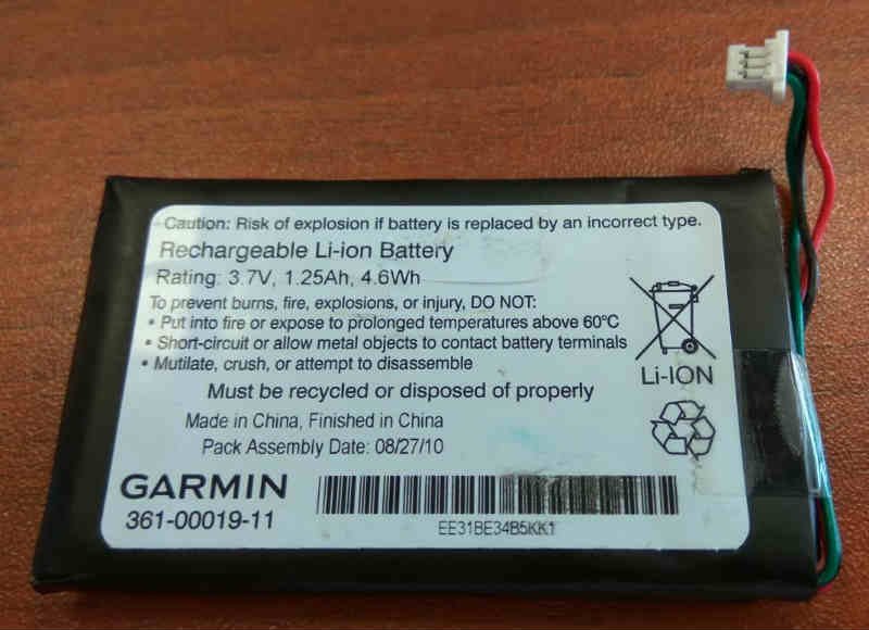
The vast majority of navigation devices for cars are conditionally portable. They have their own rechargeable batteries, the capacity of which on average does not exceed 1000 mAh. - this is enough for battery life for 1-2 hours. But, basically, automotive gadgets of the mid-budget group are powered through a network cable from a cigarette lighter socket with a nominal voltage of 12 V.
If you intend to use the navigator both in cars and on foot, take a closer look at more expensive models with lithium-polymer batteries (Li-pol). With the same dimensions, they are better in terms of energy consumption, have a low self-discharge, therefore they are much more enduring than usual ones and are able to work until they are completely discharged for about 4-5 hours.
6. Operating system
We study which OS is better - Windows or AndroidWe will immediately stipulate that the implementation of the main task - error-free orientation in an unfamiliar area - does not depend on the type of operating system. You need to think about it only if the gadget should be multifunctional.
The most common operating system installed in navigators was and still is Windows CE. Its advantages include undemanding to hardware capabilities, nice interface and clear interaction with navigation software. But in terms of speed and availability of additional applications, Windows is inferior to more modern operating systems.
These include primarily "Android". It is more complex and requires more productive hardware, so andro-navigators are more expensive, but they win in terms of functionality.Such models allow you to easily install additional software, connect to the Internet and update over the air, instantly download data and play multimedia files.
Some manufacturers of navigators have offered their own operating systems. So, Garmin appeared models with the operating system of the same name. Users praise it for its performance, reliability and stability, but they also blame it for a rather limited selection of software. Against its background, Android looks much more promising.
7. Navigation software
Overview of maps and programs for navigation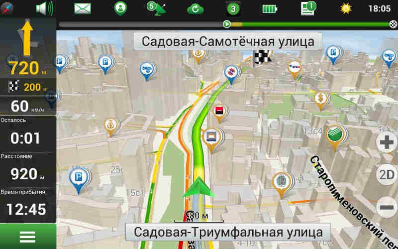
Whatever the capabilities of the navigator, they try to choose it in order to accurately determine their location at any time and know where the further route lies without traffic jams and congestion. For the implementation of these functions in the navigator, software products with a set of corresponding maps are responsible. The minimum requirements for them are the availability of a detailed map of your region, the maximum requirements are for the whole world.
For several years now, the following programs have remained the most popular in Russia:
- Navitel is a system with correct street names and house numbers that suits most users with speed and positioning accuracy;
- Garmin - works exclusively on branded devices, is perfectly detailed (down to the numbering of cases), has the PhotoReal function and provides a free Jam service;
- iGo - designed for long-distance travel by car, offers high-quality 3D maps for more than 70 countries, understands voice instructions in 40 languages, and recalculates the route in case of deviation.
The quality of maps in some regions still leaves much to be desired, so they need to be updated regularly.Not all manufacturers have a friendly pricing policy for the supply of new software versions, so before buying, check on what conditions and at what price you will receive updates.
8. Warm and cold start
What speed of restoration of communication with satellites is considered optimalData transmitted by GPS satellites is only valid for 30 minutes. Accordingly, if the navigator is turned off for several days or transported off to another region, its data will be outdated, and the device will need time to restore communication and return to working condition. This process is called "cold start". Its speed depends on many factors (type of antenna and chipset, signal strength, presence of interference) and can take up to 10 minutes.
If the power of the GPS receiver is turned off for a short time, it will perform a “warm start”, the duration of which rarely exceeds a few seconds. Even faster, the device will restore satellite surveillance if it loses the signal, for example, when the car is in a tunnel, in a yard between skyscrapers or under a large bridge. Of course, it is unlikely that anyone will choose a device based solely on the start speed, but it’s definitely worth looking into the technical specifications and finding out its duration.
9. TOP manufacturers
Are there brands more popular than Garmin, their pros and cons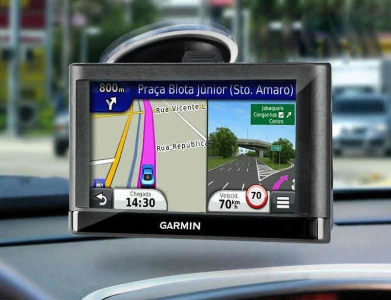
Fans of the Garmin brand are unlikely to agree that navigators from other manufacturers are not inferior to their favorites. Indeed, judging by the reviews, the American brand is significantly ahead of its competitors due to manufacturability, a wide range of models and unique navigation functions.Nevertheless, many find wormholes, they say, expensive, and the equipment is modest, and budget devices (up to $ 200) are not as high quality as you expect from Garmin.
Under the second number in the ranking of the best manufacturers is the Russian brand Navitel. He managed to offer users affordable and at the same time functional GPS devices equipped with good hardware, high-quality programs and good maps. For use in Russia, it is probably difficult to choose the best devices, but when traveling abroad, they can fail, since some maps of other countries are out of date.
For foreign countries, especially for trips around Europe, devices from the Dutch company TomTom are considered ideal navigators. She provided her users with a smart MapShare technology that allows them to independently make changes to maps and share innovations with other owners of the gadget. But the automatic switching of day and night modes, backlighting and a quick exit from the wilds of the TomTom menu are clearly not enough.
10. Interface and equipment
Everything for the correct interaction with the deviceNow you are ready to go to the store to test a particular model. We recommend doing this even if you plan to buy a gadget through an online store. First, check that the box contains the main accessories: cradle, charger, cigarette lighter cord and USB cable. Richer packages may additionally include a case, an external antenna, a household power adapter, a paired rear view camera, software, etc.
Find out where the memory card slots, SIM cards, USB port, headphone output are located and evaluate how convenient their location will be for you.Some designations of connectors and ports may be incomprehensible, so we will decipher them:
- TRS 3.5 - headphone audio jack;
- AV-IN - connection of an external source of audio and video signal, for example, a TV tuner;
- DC-IN - input for connecting network charging;
- Reset - a hardware reset button to roll back the system to factory settings;
- IEEE 1394 is a high-speed bus for the exchange of digital information.
Now evaluate the quality of assembly, fastening and case material. It is important that the plastic is non-staining and strong to the touch, and the parts fit correctly. Install the navigator in the cradle and try to remove it. Holds securely and removes easily. So, "good boots, you must take"!


